
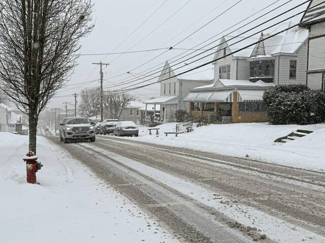

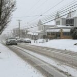
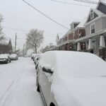
Snow falling on Sunday in Southwestern Pennsylvania was the prelude to an arctic blast with sub-zero temperatures expected early this week.
National Weather Service meteorologist Bill Modzelewski predicts 2 to 4 inches in parts of Westmoreland County and between 1 and 3 inches in Allegheny County with 5 to 9 inches in high elevations.
“Snowfall should be tapering off in the evening and it will be about over with on Monday, except for a few flurries,” he said Sunday.
Before 1 p.m. Sunday a stuck vehicle and hazardous road conditions prompted closure of Route 30 on Laurel Ridge in Ligonier Township, according to a Westmoreland County 911 dispatcher.
PennDOT lifted a temporary reduction of the speed limit to 45 mph late Sunday afternoon on Interstate 70 in Westmoreland and Washington counties and on Interstate 79 in Washington and Greene counties.
The Pennsylvania Turnpike lowered its speed limit to 55 mph between the Donegal and Somerset exits and on Turnpike 43 from the West Virginia line to Exit 30 at Route 40.
Dangerously cold weather is expected late tonight through Wed. Wind chills & temps will be coldest at night/early morning, with Wed morning being the coldest of the week. A Cold Weather Advisory has been issued for the region, with an Extreme Cold Warning for the higher terrain. pic.twitter.com/rGy8E49cdK
— NWS Pittsburgh (@NWSPittsburgh) January 19, 2025
Frigid temperatures then will be the primary concern throughout the region, from 1 a.m Monday through 1 p.m. Wednesday.
During that period, the weather service predicts wind chills as low as 19 degrees below zero, as much as 26 below zero in higher elevations.
The harshest wind chills will hit on Tuesday and Wednesday mornings, with readings as low as minus-15 degrees to minus-25 degrees, according to Jill Szwed, a meteorologist with TribLive news partner WTAE.
”Record low (actual) temperatures are safe Monday through Wednesday,” said Szwed. “These records are in the minus-15 degree to minus-18 degree range. We will not be that cold.
“Wednesday’s high may challenge a record for the date’s coldest maximum temperature.”
She said the forecast calls for a high of 12 degrees that day — compared to 10 degrees, recorded on the same date in 1961.
“January is typically our coldest month of the year, with average temperatures in the mid 30s for highs, lower 20s for lows,” said Szwed. “No surprise, we are set to end this month below normal.”
Public urged to limit exposure
Officials are urging residents to stay inside as much as possible during the multi-day cold blast, noting frostbite can occur within 30 minutes at a wind chill temperature of minus 19 degrees.
After closing Monday in observance of Martin Luther King Jr. Day, Allegheny County offices will be partially closed on Tuesday, so that non-essential employees can avoid unnecessary travel and exposure to the elements, officials said. Essential services, including public safety departments, will operate as usual.
Allegheny County Parks facilities for skating and skiing will be closed Tuesday to protect staff and patrons from prolonged exposure to the cold. Patrons who purchased tickets in advance for skate lessons or ski lift tickets will be refunded.


